During the last two months of Bicycle Pedestrian Commission meetings, staff presented on the city’s experience with physically-separated bike lanes and new bike lane striping for Christo Rey Dr.
Cupertino’s Physically Separated Bike Lanes
Starting with McClellan Road, Cupertino has preferred physically-separated lanes for arterial roads. The most ambitious of these projects is the in-progress lanes on Stevens Creek Boulevard, with phase 1 east of Wolfe Road already in place.

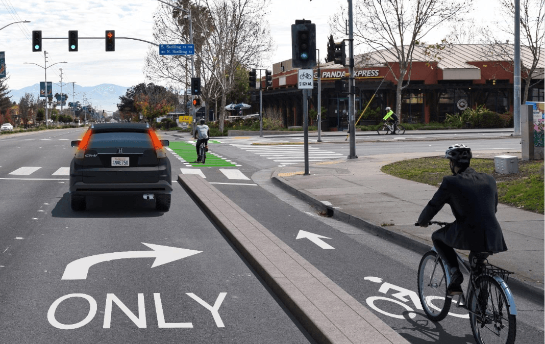
This is a conceptual picture for protected lanes on Stevens Creek Boulevard at Stelling, which has the design in progress. Protected lanes east of Wolfe Road are already installed on Stevens Creek Boulevard.

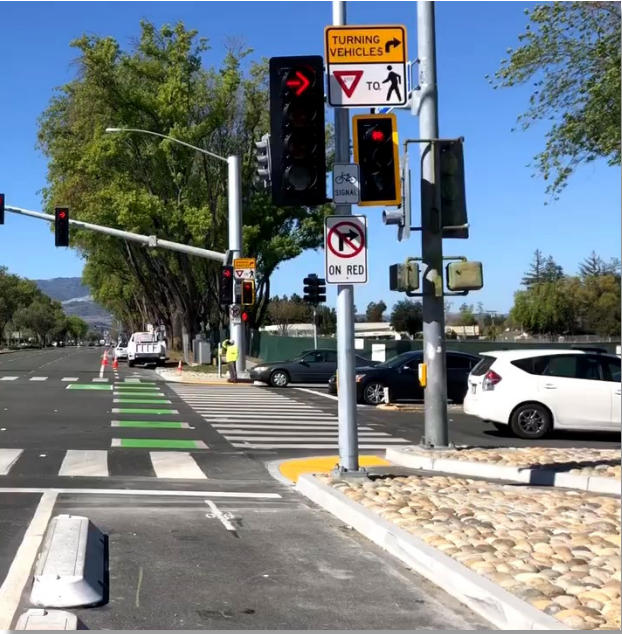
New separated bike lanes on Stevens Creek and Wolfe have special lights as well, to prevent cars from turning into a cyclist heading straight.
Challenges and Benefits to these lanes
The other roads that Cupertino has installed these lanes on are Mary Avenue north of Stevens Creek Boulevard and Bubb Road between McClellan Rd. and Stevens Creek Blvd. There are some challenges with these “Class IV” lanes:
- Driveways require a gap in the barriers.
- Trash pickup may need special accommodation.
- Sweeping protected lanes requires special equipment.
- Bike passing is difficult in narrow lanes.
Clearly, though, they provide safety that a painted stripe or even the less safer option of Bike Boulevards which have only “sharrows” in the middle of the road can’t match. (See here for a discussion on the different classes of bike lanes and the safety of each to use. See here why separated bike lanes are proven to be safer. )
“Edge friction,” or the feeling of a narrow lane while driving a car also reduces speeds. The Stevens Creek Boulevard protected lane allowed new riders to start commuting through Cupertino, instead of taking a more northerly route through Sunnyvale.
Physically separated bike lanes do not have to be separated by concrete barriers to be effective. On Mary Avenue in Cupertino, the bike lane is separated by parking spaces from car travel, with bikes traveling next to the curb and parking next to the travel lane.
Technically, these are buffered lanes (painted with extra width between cars and bike) as they are only marked with paint, but their design acts like a separated bike lane. It also allows temporarily idling vehicles, such as delivery trucks, not to block the bike lane while parked like in typical painted bike lanes.

Mary Ave. Bike lanes allow bikes to ride on the inside against the curb, while cars park against the vehicle travel lanes.
Rancho San Antonio MultiModal Access Project
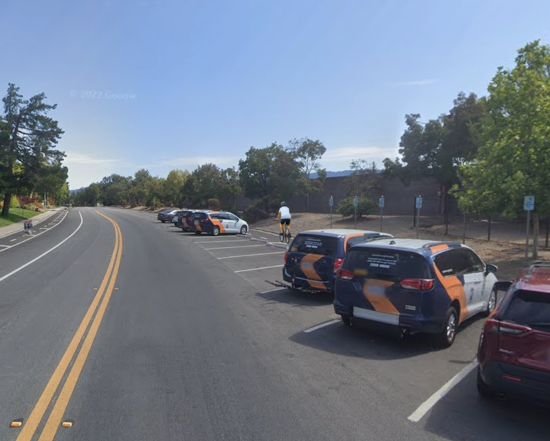
Christo Rey Drive, on the western edge of Cupertino leading to Rancho San Antonio Park, lacks safe bike infrastructure, but remains a popular route for bikes to access the park.
In the Rancho San Antonio Multimodal Access Project, Midpeninsula Open Space District vowed to work with the City of Cupertino during the upcoming repaving project. After discussing the options of different widths for each lane direction (Class II lanes) or just using sharrows (Class III lanes), the Cupertino BPC decided to take a ride on the road before making any recommendations to staff.
Bike Repair and Parking Facilities
Another discussion centered on how the City would provide bike repair and parking facilities. There were mentions of code changes to encourage parking and the best locations for bike racks. Ultimately, the commission did not take any formal action and deferred discussions of shower and changing rooms at businesses.
The Cupertino Bicycle Pedestrian Commission meets monthly on the the third Wednesday of the month. See WBC’s events calendar for the next meeting date. For official minutes and agendas of the Cupertino BPC, click here.

HI! These concrete dividers are very sharp. I was driving on McClellan today and hit one and not only did I manage to flatten my tire, I destroyed my tire. Worse, there was absolutely no where to pull my car off the road. It would be nice if the barriers could be less sharp and perhaps painted green or something bright. Thanks for your consideration. Sue
Hi Sue, thanks for the feedback, we’ve passed it on to the city. The car lanes on McClellan were narrow to begin with and have become more so with the addition of the protected bike lanes. Its an adjustment for drivers for sure.
Sure and one whole lane for cars is gone in both direction. Traffic already back up on this major road. Especially at places like Whole foods drive way This is not a residential street like Mary.
Thanks for your input, Tom. We’ve found that with no-right-on-red signs and bicycle traffic signals, safety for cyclists is significantly increased if there is a protected bike lane to the right of traffic. Many very experienced cyclists (for example, those that wear spandex on a regular basis to ride) do not see a need for protected bike lanes, but as they act as encouragement and a layer of safety for less experienced or younger cyclists, WBC is in favor of them.
As a motorist, I am very uncomfortable making a right turn when there is a protected bike lane to my right. I much prefer the old system where I can pull into the rightmost lane (even if it is bike lane) before making my turn. That way I can focus my attention on the oncoming and cross traffic without having to be constantly worried that a bicyclist could be passing me on the right. As a bicyclist, I prefer that system too — having cars that want to turn right to the left of me at an intersection simply feels unsafe.
PS – I just noticed that the designers have done just that – looking closely, I see there is a separate “bike signal” for cyclists, and they have green while the right-turning car has red. Good idea! Please preserve that in the final implementation.
Thought should be given to preventing right hook collisions in situations like that shown in the “conceptual picture for protected lanes on Stevens Creek”. Perhaps with signals – with no vehicle right turn allowed when bikes have green, and red light for bikes when cars are allowed to turn right.