Cupertino sits at an average elevation of 236 feet above sea level with steep hills on its western and southern borders.
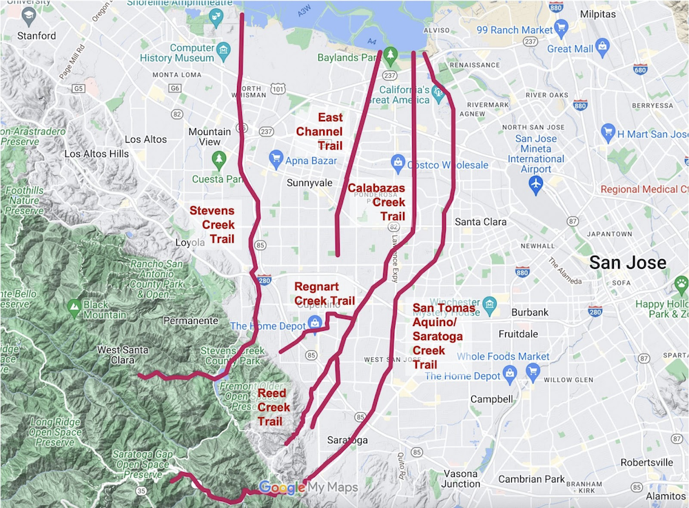
The land slopes gently down from there to the bay. Its unique location means that Cupertino is near the headwaters of several creeks in the South Bay. If these creeks are developed as trails, Cupertino residents will be able to use a creek trail to get pretty much anywhere in Mountain View, Sunnyvale, Santa Clara, and North San Jose.
From west to east, here are the waterways touching Cupertino:
- Stevens Creek – it flows through the western part of the city starting in the Cupertino hills and flowing down through Sunnyvale and Mountain View to end in the Bay near Moffett Field.
- East Channel – It connects to Cupertino at Blaney and Homestead and flows down to the Sunnyvale Baylands
- Regnart Creek – Its origin in the Cupertino hills has been covered with developments. It surfaces at Bubb and flows east across the city to end in the Calabazas Creek at Creekside Park
- Calabazas Creek – It crosses diagonally through the east half of city from south of Creekside Park through Main Street Cupertino and past the Apple Visitor Center
- San Tomas Aquino/Saratoga Creek – It starts in the hills above Saratoga and flows through the eastern edge of the city, though the future Lawrence Mitty Park and into the bay near Alviso

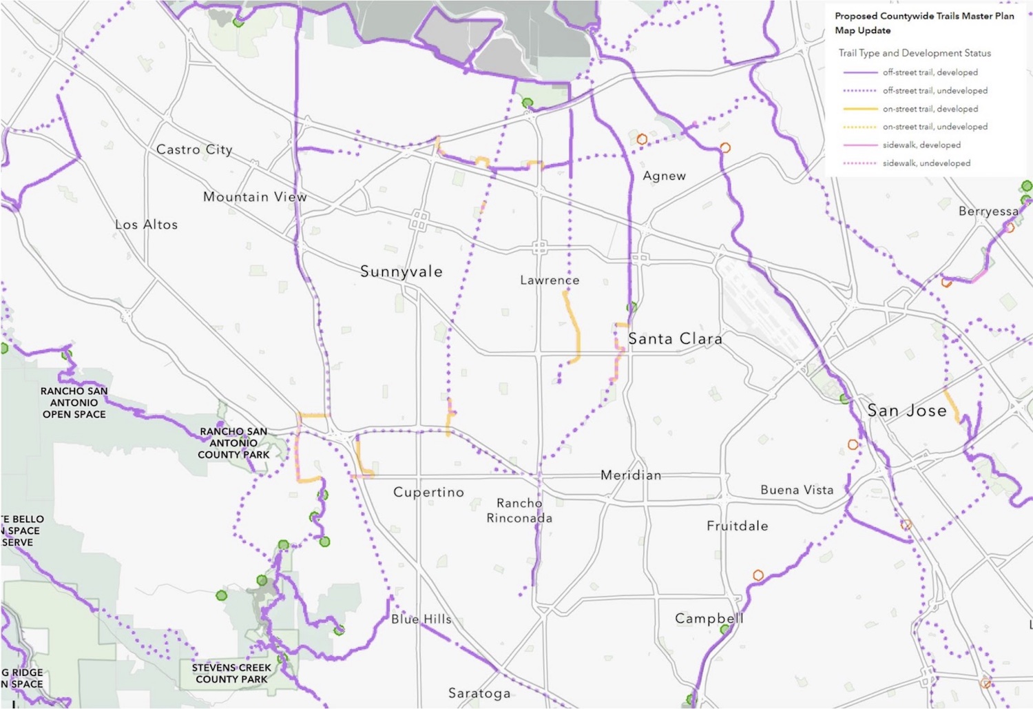
Santa Clara County Trails Master Plan
The Santa Clara County Trails Master Plan envisions creating a connected network of trails throughout the county. One of the components of this master plan is to develop the creek trails wherever possible, working with the individual cities to implement the projects.
Given its unique location, Cupertino will benefit more than any other city from developing these creek trails, connecting our residents to much of the South Bay with protected nature trails, away from cars and traffic.
Stevens Creek Trail
The city of Sunnyvale is in the final stages of approving the extension of the Stevens Creek trail from Mountain View south to Fremont Ave. Once that is built, there will only be a short gap remaining inside Cupertino to connect the trail fully from the hills all the way down to the bay. The trail will connect Cupertino residents to Los Altos, Mountain View, west Sunnyvale, Shoreline Park/Amphitheater, Google and Microsoft offices, NASA Ames Research Center, and more.
East Channel Trail
Cupertino residents will be able to go north on Blaney and cross Homestead on this trail to the Sunnyvale Baylands, Google offices, Lockheed Martin, Yahoo, Twin Creeks Sports Complex, Baylands Park, and the Bay Trail. The trail is in the Sunnyvale Active Transportation Plan.
San Tomas Aquino/Saratoga Creek Trail
This trail extends from the Bay Trail all the way to Pruneridge Avenue near Maywood Park in the City of Santa Clara, stops, restarts again at Sterling Barnhart Park in Cupertino, then continues south to just before Prospect Avenue. The City of Cupertino is planning a feasibility study to explore continuing the trail from Sterling Barnhart Park through the future Lawrence Mitty Park to Stevens Creek Boulevard. There would then be only a short segment missing from Stevens Creek Boulevard to Maywood Park to connect Cupertino residents to the Bay Trail, offices of Nvidia, Intel, Marvell, Cloudera, Johnson & Johnson, and HP Enterprise, Levi Stadium, and the Santa Clara Convention Center.
Regnart Creek Trail
The City of Cupertino just opened the eastern side of this creek trail from Cupertino Library to Creekside Park and it now connects the whole east side of the city. The remaining portion of the creek trail from De Anza to Jollyman Park and beyond is not planned for development at this time.
Calabazas Creek Trail
The Calabazas Creek goes through dense housing through most of its length, and is mostly undeveloped. The Santa Clara County Trails Master Plan hopes to develop the northern portion of the creek trail from the City of Santa Clara to the bay. In Cupertino, it passes through Creekside Park and past the Apple Campus. The city currently has no plans to develop a trail along its length to connect to the future City of Santa Clara segment.
Why These Creek Trails Matter
Creek trails connect us to the nature that is all around us. They remind us to slow down, breathe in the fresh air, notice the reeds lining the water, watch the migratory birds in flight, listen to the croaking frogs at dusk, and so much more. They improve the quality of our lives in immeasurable ways.
As density and car traffic in Silicon Valley continue to increase, our access to these creek trails becomes more and more important. They will create a network of recreation corridors for enjoyable walks in nature and family bike rides along creeks, easily accessible from wherever you live in Cupertino. They will also create safe and pleasant commuting corridors that connect Cupertino to much of the South Bay, away from cars and traffic, allowing residents to get to schools and offices faster than by car.

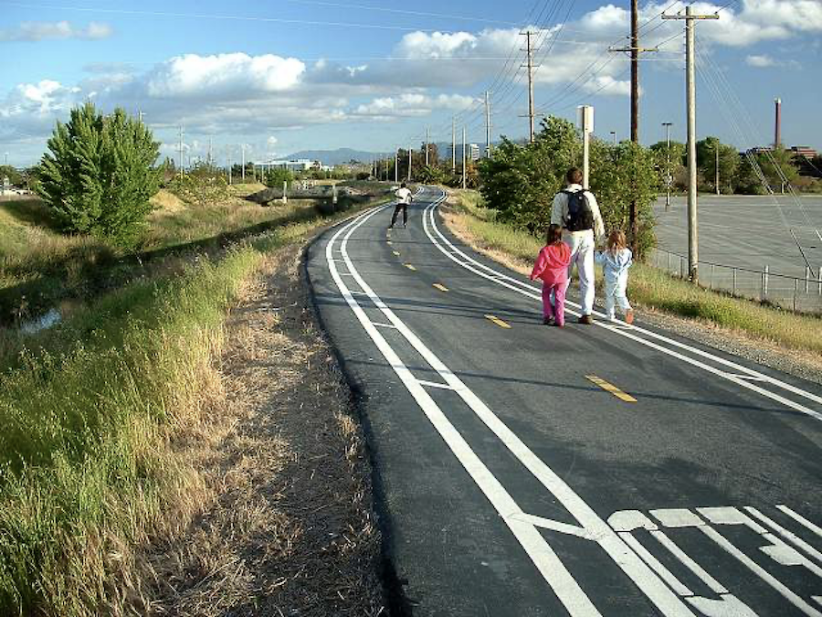
San Tomas Aquino Saratoga Creek Trail
What You Can Do
Get educated. Take time to learn more about the creeks near you that flow down from the hills and into the Bay. Visit the existing walking and biking creek trails in the South Bay. Tell your family and friends to check them out too.
Get involved. Email your council members and ask them to support the Santa Clara County Trails Master Plan. When the City of Cupertino asks for resident input, express your support for developing and connecting these creek trails. If you want to do more, drop us a note and we’ll help you get involved.
The information in this article is solely the opinion of the author and Walk-Bike Cupertino and does not reflect the opinions of any other organization or entity. For more information, contact WBC at info@walkbikecupertino.org.


I started to use creek corridors for my bike to work commute 30 years ago mostly with what was probably semi legal. So glad this is being done now.