Key Facts About UPRR Trail Project
Cost of Construction: TBD
Length of Project: 5.1 miles
Type of Project: Class 1 Pedestrian and Bicycle Trail (see here for an explanation of different types of bike facilities)
Click here for information from the City of Cupertino’s website
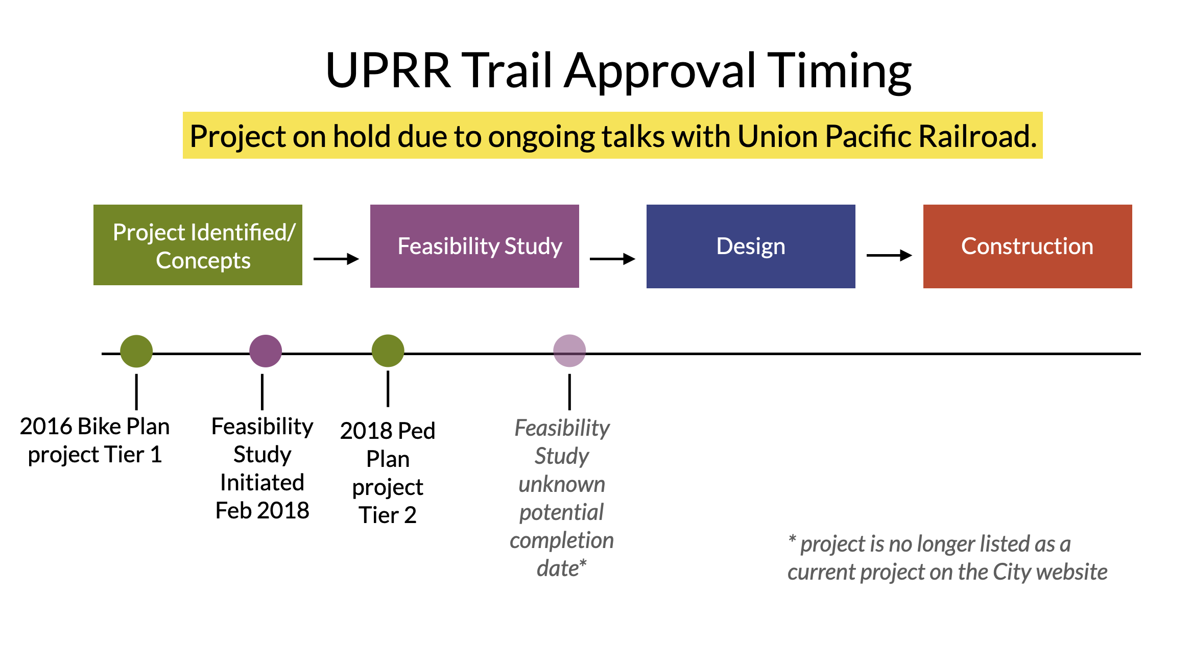
Current Status (July 2024): UPRR Trail is currently in the Feasibility Study phase. Three community workshops were held in 2018.
The City continues to try to engage with UPRR for a trail at this location, but this project is on hold pending an agreement with them.
Why Does Walk-Bike Cupertino Support this Project?
.
Safer connector
It will be a safer, off-road route to parks and many neighborhoods on the west-side of Cupertino for cyclists, walkers and runners.
New recreation option
Families, seniors, and the entire community will enjoy walking and biking on this over 5.1 mile long recreation path along the railroad siding. It will connect at its northern terminus with the Rancho San Antonio recreation area, including Deer Hollow Farm dramatically increasing its use as a recreational opportunity for Cupertino residents.
Improve health & meet neighbors
Trails get people outdoors, walking and socializing with their neighbors. This increases community health and connection for all residents.
Reduce accidents
As cars are the greatest danger to pedestrians and cyclists, avoiding interactions with them means fewer accidents while walking and biking. With a long recreational path to use conveniently located in many neighborhoods, residents will not need to cross streets or pass driveways to enjoy healthy recreation.
Increase property values
Multiple studies have shown that homes close to trails see up to a 32% increase in property values and trails are a top amenity that homebuyers look for in their purchase. Thousands of current homeowners could benefit from this new trail.
Historic De Anza Trail is a key element of variety of local planning documents
Rail-with-Trail was first identified in the 1995 Santa Clara County Trails Master Plan, VTA’s Active Transportation Plan 2020, Union Pacific Rail Trail Feasibility Study (2001), and the Santa Clara County General Plan, in addition to Cupertino’s 2016 Bicycle Transportation Plan.
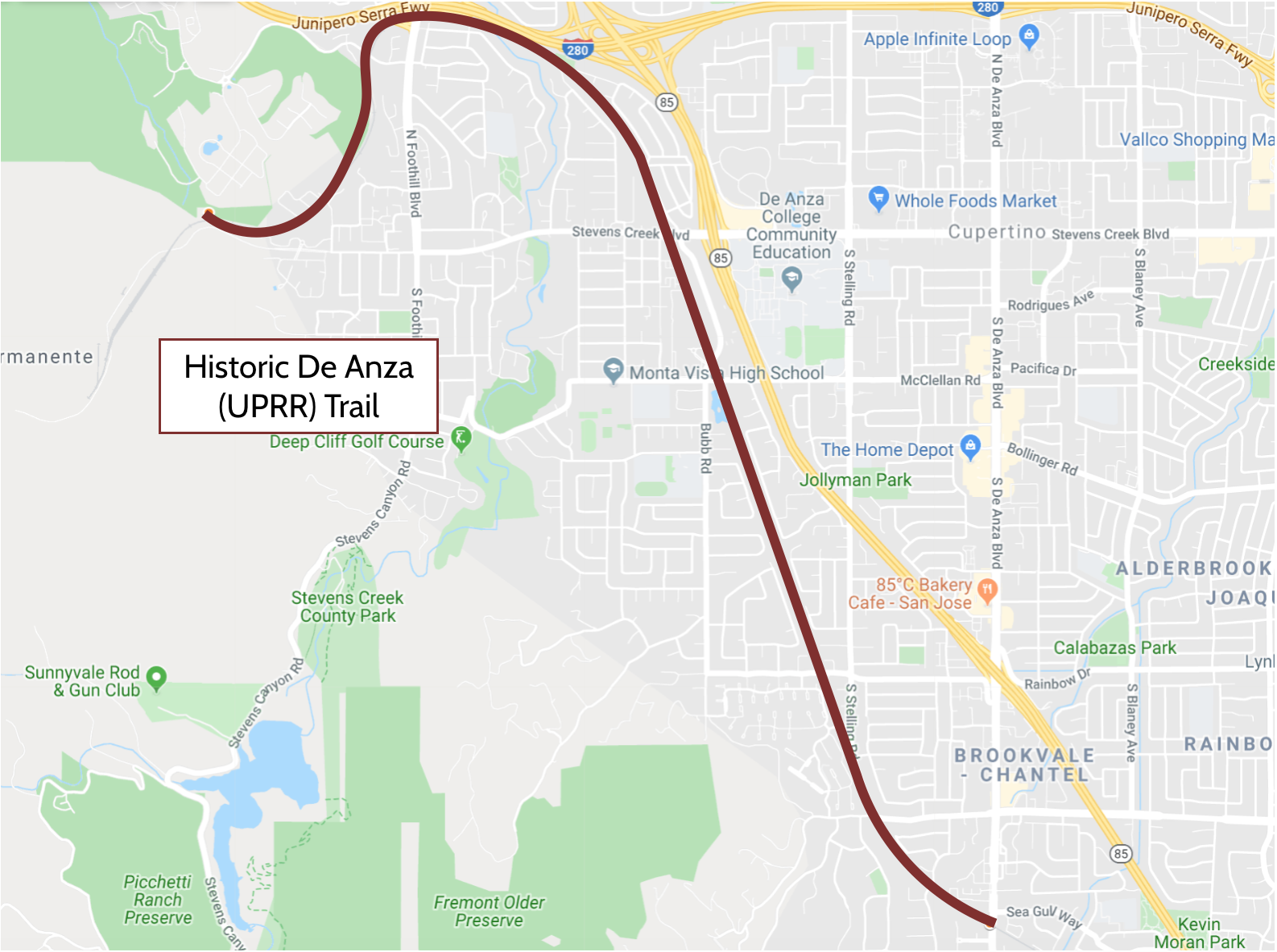
Location of Project
(click map for larger view)
How Walk-Bike Cupertino has actively supported this project
Walk-Bike Cupertino has:
Provided information, maps and data to residents, City Council and Staff regarding usefulness of this trail to cyclists and pedestrians;
Kept supporters up to date on upcoming events and milestones for the project via email newsletters;
Sent emails of support to City Council and ecouraged others to do the same;
Coordinated vocal support at City Council meetings when this topic was to be discussed;
Met with City Staff, Bicycle Pedestrian Commission, and Cupertino City Councilmembers to discuss details of project and to encourage progress and adequate staffing.


